Global Coordinate System (GCS)
The snapshot below displays the position and attitude of the optimist with respect to the Global Coordinate System (GCS) in the Offshore Basin. The xy-plane of the GCS is aligned with the Still Water Line (SWL). The x-axis points towards the 180deg wave maker in the basin. This wave maker located opposite to the control room. The z-axis points upwards and intersects position K8 on the basin floor. Multiple steady wind velocity measurements were conducted in January 2023 at three elevations (0.50m, 1.00m and 1.50m). Xy-positions of the wind probe array were inside the inner yellow contour. These measurements were converted into a spatial non-temporal wind field for the simulation model. Outside the yellow inner contour the wind velocities are by default set to zero in the simulation model. The outer contour represents the boundaries of the basin floor. Practically, it is also not possible to sail in the area between both contours in the Offshore Basin due to the presence of objects (carriage, wind bed) and the recirculation of the generated flow.
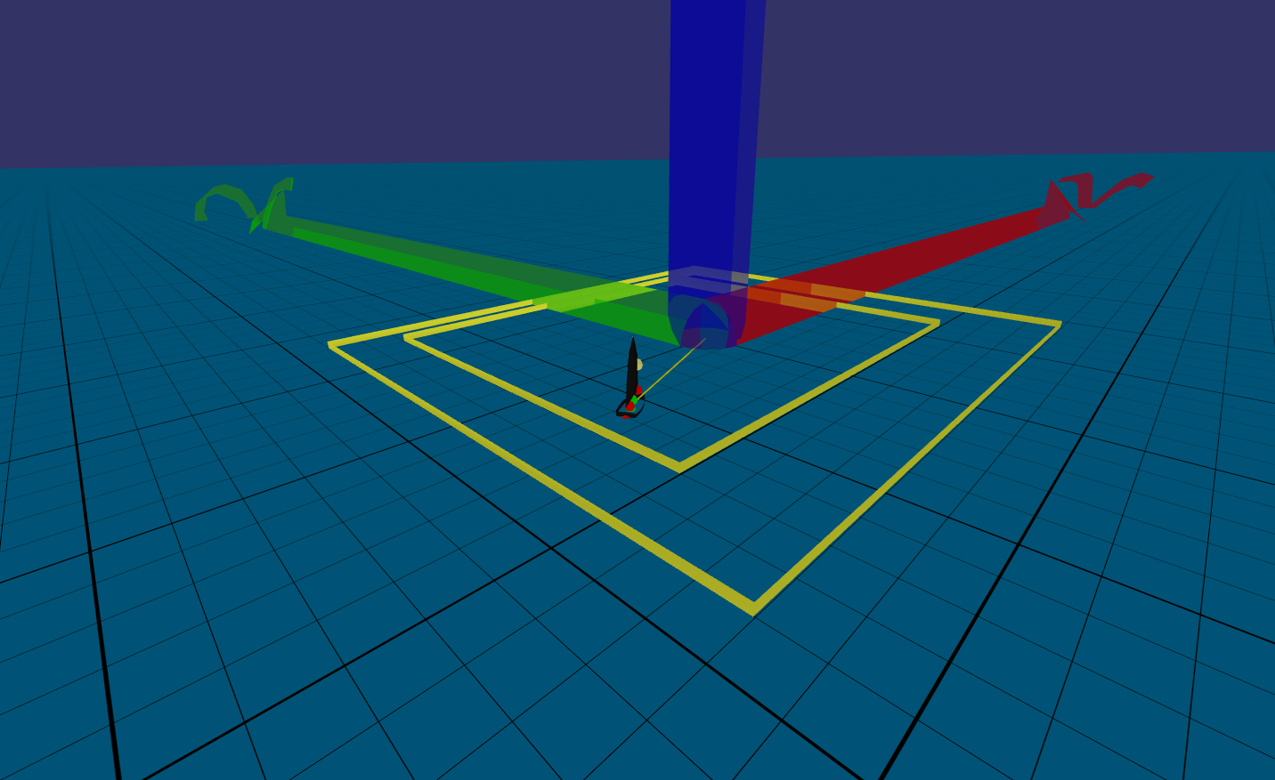
Snapshot of the Optimist in the Offshore Basin
Boundaries of the inner contour:
- Longitudinal range: 14m<x<12m
- Lateral range: -10m<y<13m
Overview
Content Tools